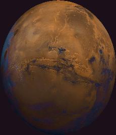
Valles Marineris, the grand valley of Mars named after the Mariner program which first took close-up images.
Click on image for full size
Image from: USGS
Valles Marineris
Valles Marineris is a large system of
canyons, shown in this image, that stretches 4000 km (2500 mi) along the equator of
Mars. It was first imaged in detail by Mariner 9. The scene to the left (centered at: lat -8, long 78) shows the entire Valles Marineris canyon system, over 2000
kilometers long and up to 8 kilometers deep. This system extends from Noctis Labyrinthus (check the large topographic map of Mars) - the arcuate system of grabens to the west, to chaotic terrain to the east. As can be seen in the image, many huge ancient river channels originate at chaotic terrain, from north-central canyons in the image, and extend north. The three Tharsis
volcanoes (dark red spots), each about 25 kilometers high, are visible on the leftmost (western) edge of the image. To the south are the highlands; very ancient terrain, covered by
many impact craters.
High resolution images returned by the Mars Global Surveyor spacecraft allow closer examination of this unusual canyon. These images show slopes descending steeply to the north and south
in broad,
debris-filled gullies with intervening rocky spurs.
Layered rocks on Earth form from sedimentary processes (such
as those that formed the layered rocks now seen in Arizona's
Grand Canyon) and volcanic processes (such as layering seen in
the Waimea Canyon on the island of Kauai). Both origins are
possible for the Martian layered rocks seen in Valles Marineris. In
either case, the total thickness of the layered rocks seen in
these images indicates that there may have been a complex and extremely active early
history for geologic processes on Mars.
You might also be interested in:

How did life evolve on Earth? The answer to this question can help us understand our past and prepare for our future. Although evolution provides credible and reliable answers, polls show that many people turn away from science, seeking other explanations with which they are more comfortable.
...more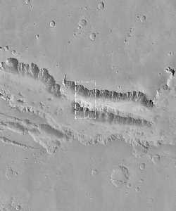
This image shows the steep slopes of Valles Marineris at higher resolution. Very high resolution images returned by the Mars Global Surveyor spacecraft allow closer examination of this unusual canyon.
...more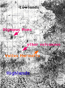
The surface of Mars can be broken into two main regions: highlands and lowlands. The highlands are in the southern hemisphere (the bottom of the figure), and the lowlands are in the northern hemisphere
...more
The presence of water near the surface of Mars, or lack of water, is a big factor in determining the climate of Mars, and the suitability of Mars to support life. Finding out what has happened to the water
...more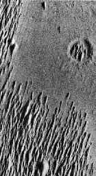
Over the course of time there are many things which can cause the surface of a planet to change its appearance. winds can slowly wear erode a planet's surface. The surface of Mars is affected by wind.
...more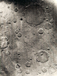
This is an example of the cratered terrain on Mars. Almost the entire surface of Mars is cratered to various degrees. The Tharsis Ridge, where the volcanoes of Mars are located, is lightly cratered. The
...more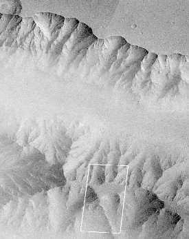
The mission of Mars Global Surveyor (MGS) is to map the surface of Mars from space, a mission somewhat akin to the Magellan mission to Venus. The MGS probe is also suppose to explore the topmost portion
...more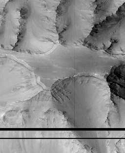
This view of Valles Marineris shows debris-filled gullies with intervening rocky spurs, reminiscent of terrestrial canyons. Layered rocks on Earth form from sedimentary processes (such as those that formed
...more