Mariner Image List
Mariner 2 - to Mercury
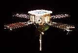
The Mariner 2 spacecraft. (Courtesy NASA/JPL)
Mariner 4 - to Mars
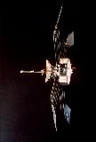
The Mariner 4 spacecraft. (Courtesy NASA/JPL)
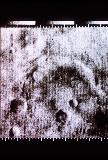
This is an image
of the Martian Atlantis crater, taken with Mariner 4. (Courtesy NASA/JPL)
Mariner 5
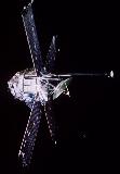
The Mariner 5 spacecraft. (Courtesy NASA/JPL)
Mariner 6 & 7 - to Mars
This image shows what the Mariner 6 & 7 spacecraft looked like. These identical spacecraft teamed up in 1969 to become the first dual mission to Mars, flying by over the equator and south polar regions and analyzing the Martian atmosphere and surface with remote sensors, as well as recording and relaying hundreds of pictures (Courtesy NASA/JPL)
This is an image of the Meridiani Sinus and Deucalionis Regio region of Mars, taken with Mariner 6 in 1969. The lower right crater is Flaugergues and the double crater to the
lower left is Wislicenus. In this image can be found many siunous features suggestive of Martian rivers, and even outflow from a central plain. Viewing of this image in high resolution is recommended. (Courtesy NASA/JPL)
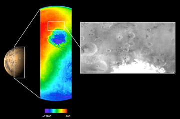
This image shows a mosaic of the south polar cap of Mars. In the lower left corner is a global view of the polar caps. The south pole of Mars contains many interesting features, such as layered terrain, which may play roles in the Martian climate. The Mars '98 mission to Mars will land in this region in 1999. In preparation for that mission, enhanced images of this same region are being taken by the Mars Global Surveyor mission. (Courtesy NASA/JPL)
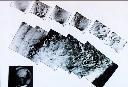
These are Mariner 7 images of Mars taken in August 1969. (Courtesy of NASA/JPL)
(106K GIF)
Mariner 9 - to Mars
The Mariner 9 spacecraft. (Courtesy NASA/JPL)
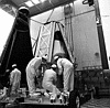
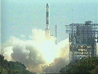
Technicians make final checks of the Mariner 9 spacecraft prior to its encapsulation. The Mars-bound spacecraft lifted off aboard an Atlas-Centaur rocket from Cape Kennedy at 6:23 p.m. EDT, May 30, 1971. Following a flight of nearly six months, the spacecraft entered its orbit becoming the first artificial satellite of Mars. Mariner 9 functioned in Martian orbit for nearly a year. (Courtesy NASA)
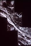
A Martian channel suggestive of flowing water, taken with the Mariner 9 spacecraft. (Courtesy NASA/JPL)
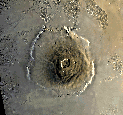
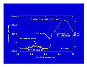
This famous picture of Olympus Mons was taken with the Mariner 9 spacecraft. (Courtesy NASA/JPL)
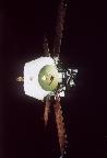
Mariner 10 - to Venus and Mercury
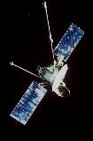
The Mariner 10 spacecraft. (Courtesy NASA/JPL)
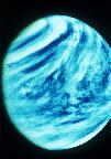
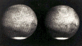
One of the first up-close images of Venus showing an almost impenetrable layer of clouds, from the Mariner 10 spacecraft. (Courtesy NASA/JPL)
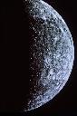
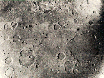
One of the first up-close images of Mercury, from the Mariner 10 spacecraft. (Courtesy NASA/JPL)
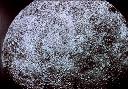
One of the first up-close images of Mercury, from the Mariner 10 spacecraft. (Courtesy NASA/JPL)
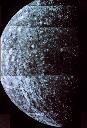
One of the first up-close images of Mercury, from the Mariner 10 spacecraft. (Courtesy NASA/JPL)
Go back to Mars, Pluto, Mercury, Saturn, Neptune, Venus, Moon, Jupiter, Asteroids, Comets, Sun, Missions, Uranus, Astrophysical Objects, Viking Images, Mars Pathfinder Images, Mars Global Surveyor Images