Mars Global Surveyor Image List
Martian Geology
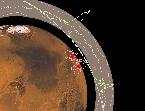
This is a labeled map showing regions imaged by Mars Global Surveyor early in the mission. Some of these regions are shown below at higher resolution. Viewing of this image in high resolution is recommended. (Courtesy Malin Space Science Systems )
Excerpt from U.S. Geological
Survey Mars Digital Image Mosaic, reproduced at a scale of 230
meters/pixel. The outlines of other images are shown as white boxes. (Courtesy Malin Space Science Systems )
Mosaic of Viking Orbiter 1 frames 428A62,
428A63, and 428A65, reproduced at a scale of 80 meters/pixel
or 40 meters/pixel full resolution. The outline of the next image is shown as a white box. (Courtesy Malin Space Science Systems )
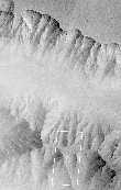
This picture
of the Martian surface was obtained in the early
evening of January 1, 1998, by the Mars Orbiter Camera
shortly after the Mars Global Surveyor spacecraft began it's
80th orbit. Seen in this view are a plateau and surrounding
steep slopes within the Valles Marineris. (Courtesy Malin Space Science Systems )
Viking Orbiter 1 frame 897A32, reproduced at a scale of 150
meters/pixel. The outline of the next image is shown as a
white box. (Courtesy Malin Space Science Systems )
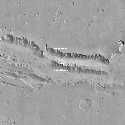
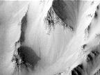
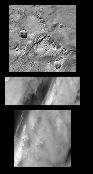
This picture of a canyon on the Martian surface was obtained a
few minutes after 10 PM PST, January 8, 1998, by the Mars
Orbiter Camera during the 87th orbit around Mars of the
Mars Global Surveyor spacecraft. It shows the canyon of Nanedi
Vallis, one of the Martian valley systems cutting through
cratered plains in the Xanthe Terra region of Mars. (Courtesy Malin Space Science Systems )
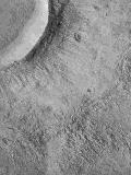
This is an image of layered terrain in the south polar region, and a potential Mars '98 landing site. (Courtesy Malin Space Science Systems )
This is an image of layered terrain in the south polar region, and a potential Mars '98 landing site. (Courtesy Malin Space Science Systems )

This is an image of layered terrain in the south polar region, and a potential Mars '98 landing site. (Courtesy Malin Space Science Systems )
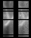
This is an image of layered terrain in the south polar region, and a potential Mars '98 landing site. (Courtesy Malin Space Science Systems )
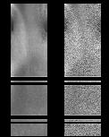
This is an image of layered terrain in the south polar region, and a potential Mars '98 landing site. (Courtesy Malin Space Science Systems )
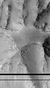
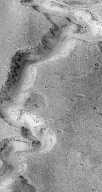
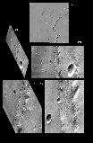
This is an image of West Tithonium Chasma, on the western edge of Valles Marineris. Note the geologic features in the image. (Courtesy Malin Space Science Systems )
This is an image of the Medusae Fossae region. (Courtesy Malin Space Science Systems )
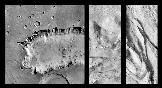
Complex floor deposits within the western Ganges Chasma. Note the geologic features in the image. (Courtesy Malin Space Science Systems - 142K)
This is image shows flow ejecta of a crater on Icaria Planum. (Courtesy Malin Space Science Systems - 153K)
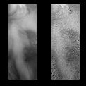
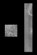
This image shows a portion of the Schiaparelli region on Mars. (Courtesy Malin Space Science Systems)
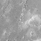
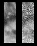
This image shows a portion of the Nirgal Vallis region on Mars. (Courtesy Malin Space Science Systems)
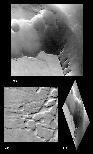
This image shows a portion of the Labyrinthus Noctis region on Mars. (Courtesy Malin Space Science Systems)
Other data returned from Mars

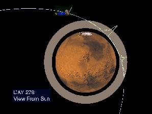
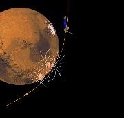
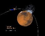
This image illustrates one way in which the magnetometer instrument studies the planet. This image also illustrates the process of aero-braking. (Courtesy NASA/JPL)
This image illustrates one way in which the magnetometer instrument studies the planet. This image also illustrates the process of aero-braking. (Courtesy NASA/JPL)
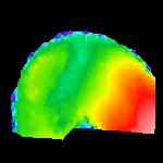
This image illustrates surface magnetic fields of Mars. (Courtesy NASA/JPL)
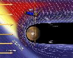
This image illustrates the Martian magnetosphere & its interaction with the solar wind. (Courtesy NASA/JPL)
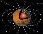
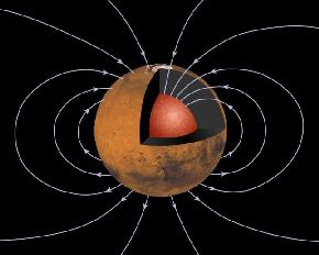
This image illustrates the global magnetic field of Mars. (Courtesy NASA/JPL)
This image illustrates surface magnetic fields of Mars. (Courtesy NASA/JPL)
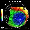
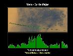
This image shows temperature data from the surface of the planet. The purple regions are the coldest, about -200 degrees F (140K), while the
red areas are the warmest at about 30 degrees F (270K). (Courtesy NASA/JPL)
This image shows temperature data from the surface of the planet. The scale to the left shows that purple regions are the coldest, about -170 degrees F (140K), while the yellow areas are the warmest at about 17 degrees F (270K). (Courtesy NASA/JPL)
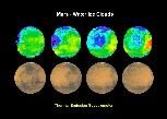
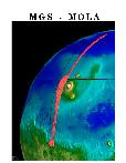
This graph shows proof of the existence of clouds of water on Mars. The sequence shows the water clouds moving across the face of Mars. (Courtesy NASA/JPL)
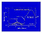
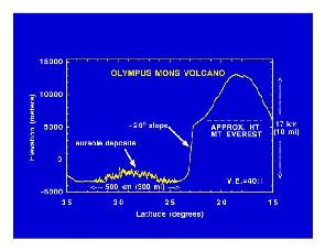
This graph shows altimeter results from Mars Global Surveyor of the size of Olympus Mons. (Courtesy NASA/JPL)
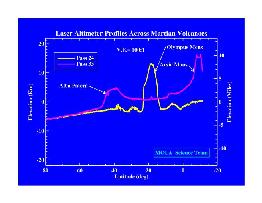
This graph shows altimeter results from Mars Global Surveyor of other volcanoes of Mars. (Courtesy NASA/JPL)

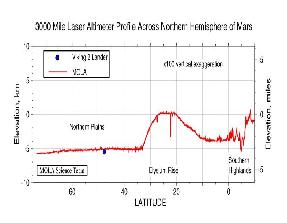
This graph shows altimeter results from Mars Global Surveyor of the size difference between the two hemispheres of Mars (northern vs southern). (Courtesy NASA/JPL)
This graph shows altimeter results from Mars Global Surveyor of other volcanoes of Mars on the Tharsis Ridge. (Courtesy NASA/JPL)
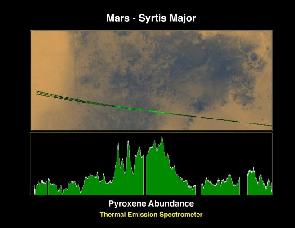
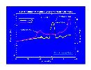
This graph shows a measurement of pyroxene on Mars. (Courtesy NASA/JPL)
The Mars Global Surveyor spacecraft
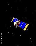
This is a schematic of the Mars Global Surveyor spacecraft. (Courtesy NASA/JPL)

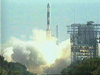
Launch of the Mars Global Surveyor spacecraft. (Courtesy NASA/JPL)
Go back to Mars, Pluto, Mercury, Saturn, Neptune, Venus, Moon, Jupiter, Asteroids, Comets, Sun, Missions, Uranus, Astrophysical Objects, Mariner Images, Viking Images, Mars Pathfinder Images