In this NASA satellite image, ice fills the Bering Strait between Alaska and Russia, moving south to the Bering Sea.
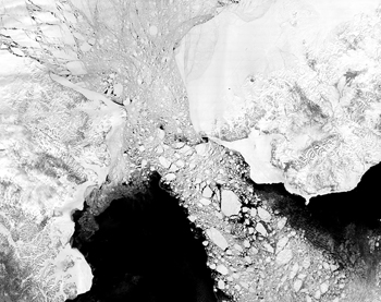
Click on image for full size
Image courtesy of NASA
Global Ice Age Climate Patterns Influenced by Bering Strait
News story originally written on January 10, 2010
Sometimes, a small change in the Earth can lead to a big change in climate.
A new study shows that changes in the Bering Strait might have affected ocean currents and climate worldwide thousands of years ago.
The Bering Strait is a narrow waterway between Russia and Alaska. It connects the Atlantic and Pacific Oceans.
Scientists used a computer model to study how the Bering Strait affected climate in the past. In the model, ice sheets grew when climate cooled. With so much water trapped on land in ice sheets, there was less water in the ocean so sea level was lower. Lower sea level meant that the Bering Strait was nearly closed. It was land, not ocean, between Russia and Alaska.
Without a connection between the north Atlantic and Pacific, ocean currents changed. A current carried warm water from the tropics to the north Atlantic. The warm water allowed the ice sheets to melt a bit. The water from the ice sheets flowed into the ocean and sea level rose. Higher sea level reformed the Bering Strait.
With the Bering Strait, the ocean currents changed again. The warm water was no longer brought from the topics. This made the north cooler. The ice sheets grew again and sea level dropped. Again, the Bering Strait mostly closed and this changed the ocean currents.
The pattern was finally broken about 34,000 years ago, when Earth became farther from the Sun during northern winter. This caused temperatures to be so cool that the ice sheets grew even when the Bering Strait closed.
Last modified February 19, 2010 by Lisa Gardiner.


Shop Windows to the Universe Science Store!
Our
online store includes
issues of NESTA's quarterly journal, The Earth Scientist, full of classroom activities on different topics in Earth and space science, ranging from
seismology,
rocks and minerals,
oceanography, and
Earth system science to
astronomy!
You might also be interested in:

To figure out what the Earth might be like in the future, scientists need to know how Earth reacts to changes. Models help scientists to better understand how the Earth works and how it will react to climate
...more
This page is not yet developed at the elementary level. Please check back for updates or click on the "Intermediate" button above for information.
...more
Sea level is the height of the ocean surface. Scientists measure sea level to figure out how much sea level rise is happening now because of global warming. If you tried to draw a flat line at the top
...more
Scientists have learned that Mount Hood, Oregon's tallest mountain, has erupted in the past due to the mixing of two different types of magma. Adam Kent, a geologist at Oregon State University, says this
...more
The Earth's mantle is a rocky, solid shell that is between the Earth's crust and the outer core. The mantle is made up of many different reservoirs that have different chemical compositions. Scientists
...more
Some faults look strong and like they wouldn’t cause an earthquake. But it turns out that they can slip and slide like weak faults causing earthquakes. Scientists have been looking at one of these faults
...more
The sun goes through cycles that last approximately 11 years. These solar cycle include phases with more magnetic activity, sunspots, and solar flares. They also include phases with less activity. The
...more