Cloud Image Gallery
Go to: Altocumulus Altostratus Cirrocumulus Cirrostratus Cirrus Cumulonimbus Cumulus Nimbostratus Stratocumulus Stratus Contrails Kelvin-Helmholtz Lenticular MammatusClick on images for full size.
Altocumulus
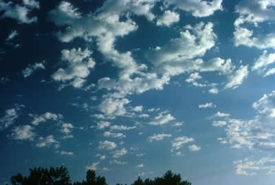 |
Occasionally altocumulus clouds show vertical development and produce tower-like extensions. These altocumulus clouds are in the early stages of development. ( Courtesy of UCAR Digital Image Library) |
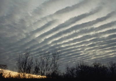 |
Sometimes altocumulus clouds appear as white or gray puffy masses in ripples or waves. ( Courtesy of Peggy LeMone) |
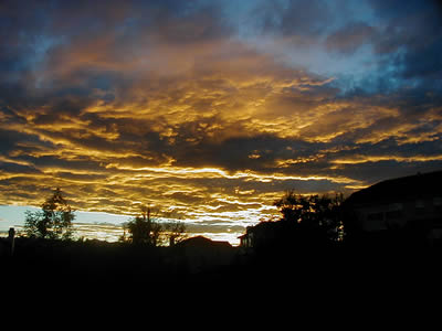 |
Photo of altocumulus clouds at sunset (Courtesy of Roberta Johnson) |
Altostratus
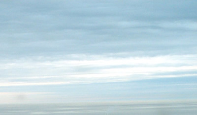 |
This is an image of altostratus clouds. Notice the difference in thickness and color in the clouds. ( Courtesy of Keith G. Diem. Used by permission.) |
 |
This image of altostratus clouds was taken in Boulder, Colorado. ( Courtesy of Carlye Calvin) |
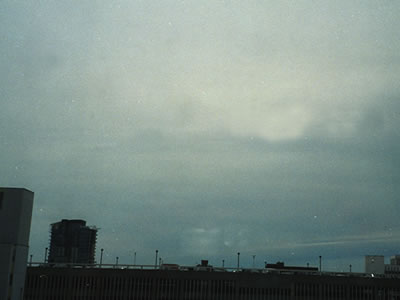 |
This photograph of altostratus clouds was taken in Calgary, Canada. Notice the bright part of the cloud that is covering the sun. (Courtesy of Peggy LeMone) |
Cirrocumulus
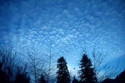 |
This is an image of cirrocumulus clouds. Sometimes cirrocumulus clouds are made up of groups of small, rounded puffs (like the clouds in this image), and sometimes they appear in long, parallel bands. ( Courtesy of UCAR Digital Image Library) |
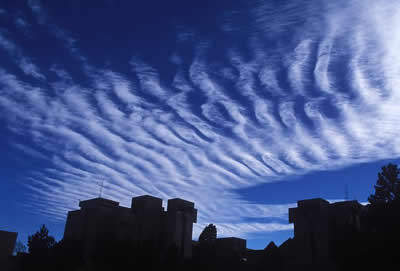 |
Cirrocumulus clouds sometimes appear in parallel bands like these clouds. This is also called a "mackerel sky" because the clouds look like the scales of a mackerel fish. ( Courtesy of UCAR Digital Image Library) |
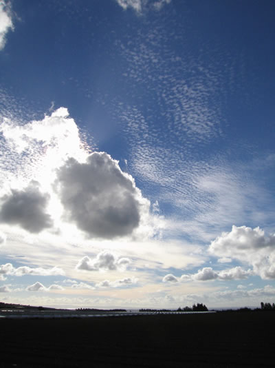 |
This photograph includes cirrocumulus clouds in the center and top of the image and cumulus clouds in the center and lower portion of the image. Notice that the cirrocumulus cloud cells appear smaller than the cumulus clouds. (Courtesy of Bob Henson/UCAR) |
Cirrostratus
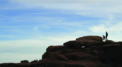 |
This image of cirrostratus clouds was taken near Moab, Utah. ( Courtesy of Anne Pharamond) |
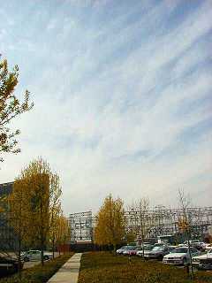 |
This is an image of cirrostratus clouds. ( Courtesy of NASA) |
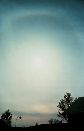 |
This is an image of cirrostratus clouds. You can see the sun through these clouds, as well as a big halo or circle around the sun. ( Courtesy of NOAAs National Weather Service) |
Cirrus
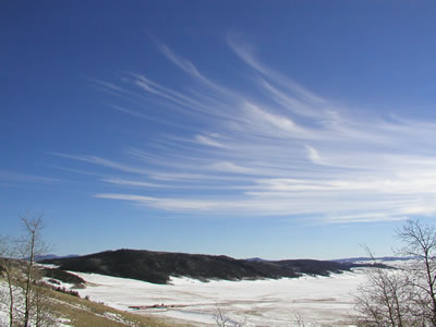 |
This is an image of cirrus clouds. ( Courtesy of Lisa Gardiner) |
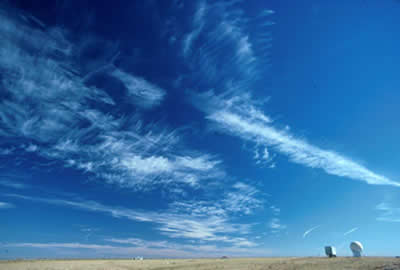 |
This is an image of cirrus clouds. These clouds are thin, wispy, and feathery. ( Courtesy of UCAR Digital Image Library) |
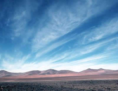 |
Cirrus clouds may appear even over some of the world's driest areas, such as the high Atacama Desert of northern Chile. ( Courtesy of Caspar Ammann/UCAR) |
Cumulonimbus
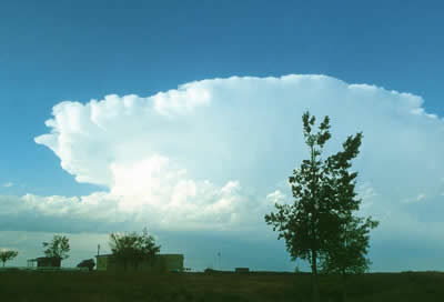 |
This cumulonimbus cloud has the characteristic anvil-shaped top. ( Courtesy of UCAR Digital Image Library) |
 |
This photograph of a cumulonimbus cloud was taken near Fort Lupton, Colorado. You can see some towers growing in this cloud. (Photo courtesy of Gregory Thompson) |
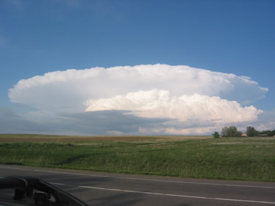 |
This cumulonimbus cloud is well-developed and shows the characteristic anvil-shape. (Courtesy of Roberta Johnson) |
Cumulus
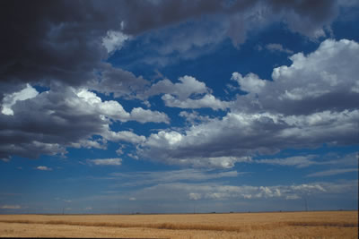 |
This is an image of cumulus clouds. ( Courtesy of Carlye Calvin) |
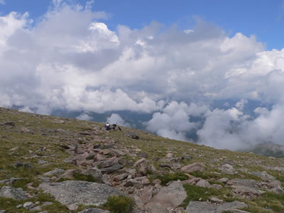 |
This image of cumulus clouds was taken in the mountains of Colorado. You can tell this was taken in the mountains because some of the clouds appear to be below the person taking the photograph! (Courtesy of Olga and Sergei Kuznetsov) |
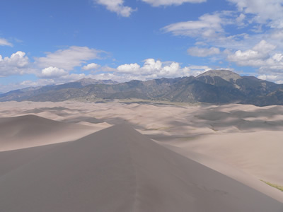 |
View of cumulus clouds from the Great Sand Dunes National Park and Preserve near Alamosa, Colorado. (Courtesy of Olga and Sergei Kuznetsov) |
Nimbostratus
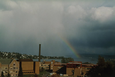 |
This image of nimbostratus clouds was taken in Seattle, WA. Notice the rain falling out of the cloud as well as the rainbow! ( Courtesy of Peggy LeMone) |
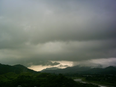 |
This is an image of nimbostratus clouds. (Courtesy of English Wikipedia) |
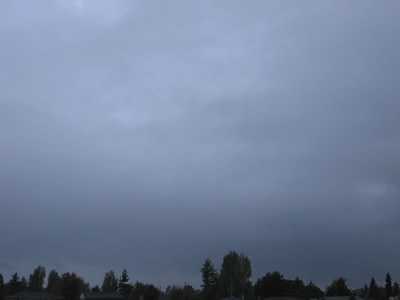 |
Photograph of nimbostratus clouds, taken in Victoria, BC, Canada (Courtesy of the University of Victoria School-Based Weather Station Network) |
Stratocumulus
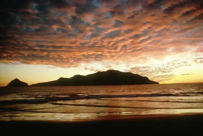 |
This photograph is of stratocumulus clouds at sunset. ( Courtesy of Carlye Calvin/UCAR) |
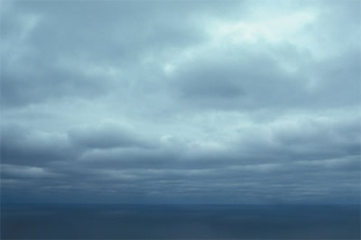 |
This is an image of stratocumulus clouds. ( Courtesy of Peggy LeMone) |
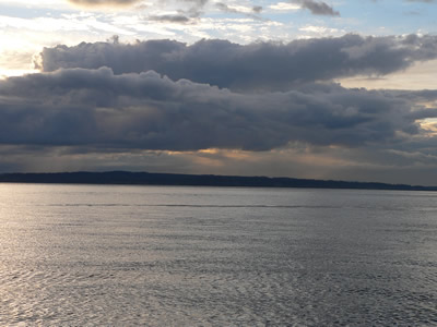 |
These stratocumulus clouds appear in linear clumps across the sky. (Courtesy of Olga and Sergei Kuznetsov) |
Stratus
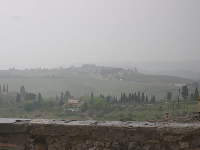 |
This image of stratus clouds was taken in San Giamano, Tuscany, Italy. The stratus cloud appears as fog on the ground. ( Courtesy of Sara Martin) |
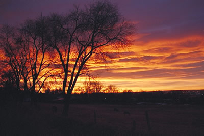 |
Stratus clouds at sunrise in eastern Colorado (Photo courtesy of Gregory Thompson) |
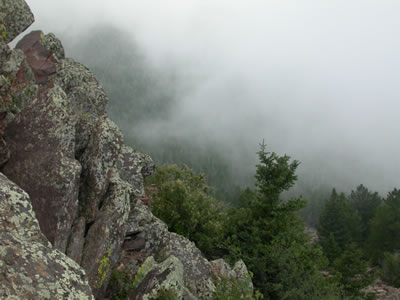 |
This type of stratus cloud forms in mountainous areas. (Courtesy of Olga and Sergei Kuznetsov) |
Contrails
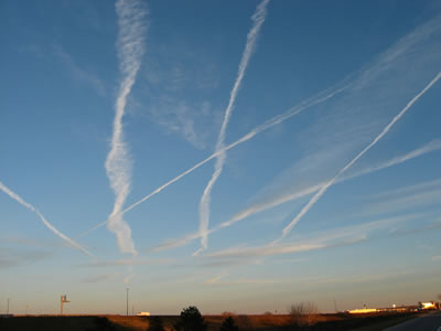 |
This photograph shows many contrails in the sky near Sutherland, NE (November 2004). (Courtesy of Susan Gallagher) |
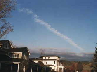 |
This is an image of a persistent spreading contrail taken in Boulder, CO on April 12 2007. (Courtesy of Peggy LeMone) |
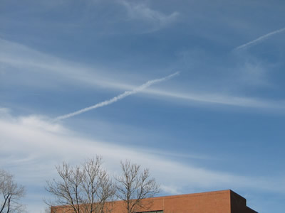 |
This is a photo of a persistent non-spreading contrail taken in Boulder, CO. (Courtesy of Kirsten Meymaris) |
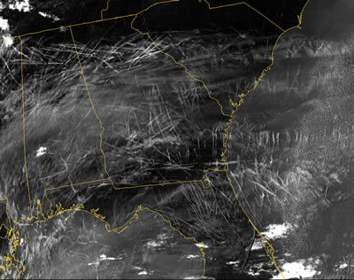 |
This enhanced infrared image from the Moderate Resolution Imaging Spedtroradiometer (MODIS), aboard NASAs Terra satellite, shows widespread contrails over the southeastern United States during the morning of January 29, 2004. The crisscrossing white lines are contrails that form from planes flying in different directions at different altitudes. Each contrail spreads and moves with the wind. Contrails often form over large areas during winter and spring. (Courtesy of NASA's Earth Observatory) |
Kelvin-Helmholtz
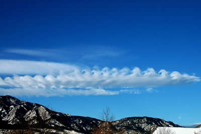 |
Kelvin-Helmholtz clouds resemble breaking waves in the ocean. They are usually the most developed near mountains or large hills. Wind deflected up and over a barrier, like a mountain, continues flowing through the air in a wavelike pattern. Complex evaporation and condensation patterns create the capped tops and cloudless troughs of the waves. (Courtesy of Benjamin Foster/UCAR) |
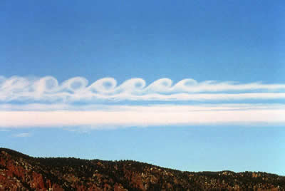 |
This is a photograph of Kelvin-Helmholtz clouds, which resemble breaking waves in the ocean. In this image, the wind is blowing from left to right. (Courtesy of Terry Robinson/UCAR) |
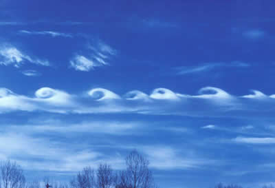 |
This is a photograph of Kelvin-Helmholtz clouds, which resemble breaking waves in the ocean. In this image, the wind is blowing from right to left. (Courtesy of Terry Robinson/UCAR) |
Lenticular
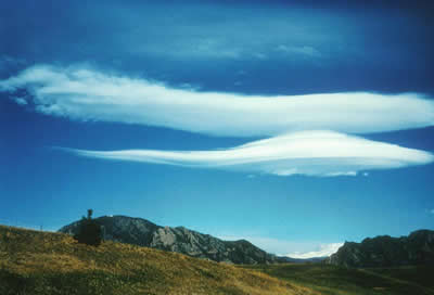 |
Lenticular, or lee wave, clouds form downwind of an obstacle in the path of a strong air current. In the Boulder, Colorado, area, the obstacle is the Front Range of the Rocky Mountains, seen through clouds at the bottom of the picture. (Courtesy of UCAR Digital Image Library) |
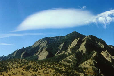 |
Lenticular clouds form downwind of an obstacle in the path of a strong air current. In the Boulder, Colorado, area, the obstacle is the Front Range of the Rocky Mountains, seen at the bottom of the picture. (Courtesy of UCAR Digital Image Library) |
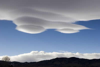 |
Lenticular clouds, taken near Boulder, Colorado (Courtesy of Carlye Calvin/UCAR) |
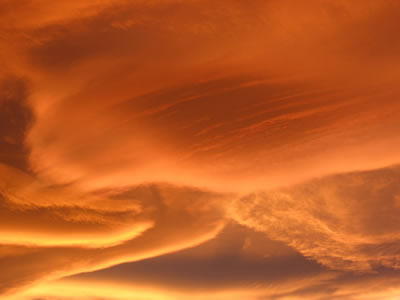 |
This close up of lenticular/lee wave clouds was taken at sunset. (Courtesy of Roberta Johnson) |
Mammatus
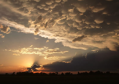 |
This is a photo of mammatus clouds, taken in Weld County, Colorado. The setting sun highlights the shapes in the clouds. (Photo courtsey of Gregory Thompson) |
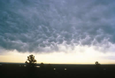 |
This is an image of mammatus clouds. (Courtesy of Carlye Calvin/UCAR) |
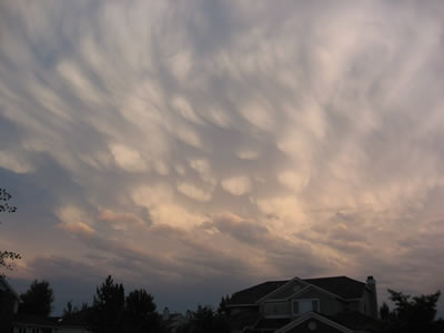 |
This photograph of mammatus clouds was taken at sunset. Notice how the light from the sun highlights the round features of these clouds. (Courtesy of Roberta Johnson) |
 Images and Multimedia on Windows to the Universe
 CMMAP - Studying Clouds and Climate
Last modified November 19, 2007 by Becca Hatheway.


