

Check out resources from our Affiliates!
Global locations of visitors using this page right now
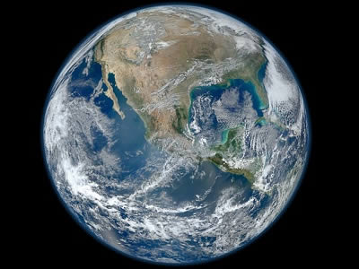
Welcome to Windows to the Universe - your portal to discovery! Explore the wealth of information available here to learn about the Earth and Space sciences and related topics in the humanities including mythology, art, poetry, and more.
Our mobile website version is available now on your phone's web browser and give us feedback.NEW Subscription Opportunities for Educators and their Students! - Classroom, School, and District Subscription Options.
Windows to the Universe Professional Development - On-site, in your school - find out more about this opportunity here. Information about our upcoming workshops and events is available on our Teacher Resources/Workshops page.
What's New on the Site?
When Nature Strikes - Earthquakes
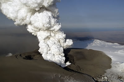
When Nature Strikes - Volcanoes
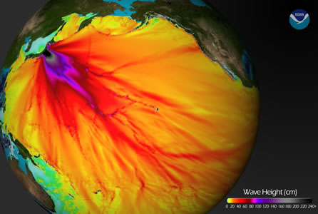
When Nature Strikes: Tsunami Classroom Activity
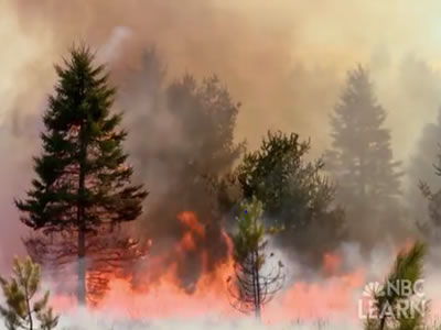
When Nature Strikes: Wildfires - Why are they a challenge to stop?
Windows to the Universe Community | |
News | Opportunities |


Podcasts from the National Science Foundation
Geologists at Harvard University found evidence that sea ice extended to the equator up to 716.5 million years ago. Listen to this and other podcasts ...Read moreBrought to you by NSF
CMMAP - Studying Clouds and Climate
Clouds are an important part of Earth's weather and climate. Scientists use computer models to study our planet's climate ...Read moreBrought to you by CMMAP
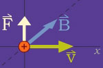
Physics of Space Weather
The science of physics plays a key role in many space weather phenomena. Charged particles, magnetic fields, forces and motion, and the electromagnetic spectrum are all part of space weather ...Read moreBrought to you by CISM

Archimedes
Archimedes was a Greek mathematician and engineer who lived between 287-212 B.C. His greatest contributions are in the field of geometry and in the development of war machines ...Read more
Historical Events
Full Earth and Space Science History Calendar (Members only)
Teacher Opportunities
Full Teacher Events Calendar (Educator Members only)
Buried Treasure!
Megaliths Revealed
Many people are interested in the mysterious megalithic structures that can be found around the world....Read more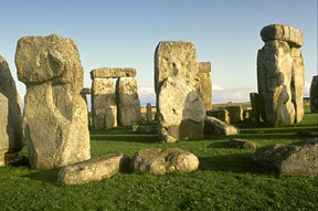
Please log in
Science Blogs
Real Climate: climate science from climate scientists

Windows to the Universe, a project of the National Earth Science Teachers Association, is sponsored in part is sponsored in part through grants from federal agencies (NASA and NOAA), and partnerships with affiliated organizations, including the American Geophysical Union, the Howard Hughes Medical Institute, the Earth System Information Partnership, the American Meteorological Society, the National Center for Science Education, and TERC. The American Geophysical Union and the American Geosciences Institute are Windows to the Universe Founding Partners. NESTA welcomes new Institutional Affiliates in support of our ongoing programs, as well as collaborations on new projects. Contact NESTA for more information.
