

Pick a Postcard - Earth
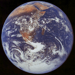 This photo was taken in December 1972 by the Apollo 17 crew. The reddish landmass is Africa and Saudi Arabia which is desert. The white is both clouds and the ice covering Antarctica. NASA/JPL | 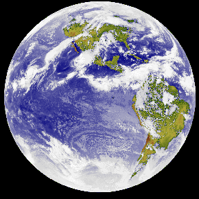 This infrared image of the Earth was taken by the GOES 6 satellite on September 21, 1986. Courtesy of Rick Kohrs |
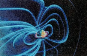 This is a picture of the Earth's magnetic field and the Van Allen Belts. The Van Allen Belts are two layers where the atomic particles are trapped and the magnetosphere is dense. Aris Multimedia Entertainment, Inc. 1994 |  This is a rendered image of Earth. Aris Multimedia Entertainment, Inc. 1994 |
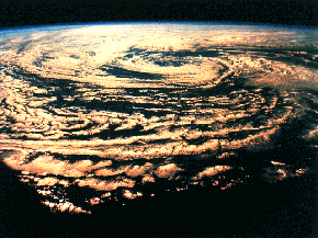
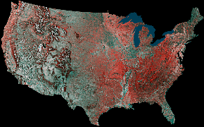 This United States is a false-color infrared mosaic prepared by using 16 images from the Advanced Very High Resolution Radiometer (AVHRR) sensors on the meteorological satellites NOAA-8 and NOAA-9. Courtesy of USGS |  Image of clouds taken by the STS-63. NASA/JPL |
 This is an image taken of cumulonimbus clouds in the atmosphere. Aris Multimedia Entertainment, Inc. 1994 | 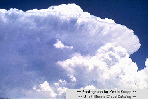 This is an image of a supercell. This occurs when cumulonimbus clouds quickly develop into powerful thunderstorm clouds. Courtesy of Kevin Knupp, University of Illinois cloud catalog |
 This is an image of a Cyclonic Storm. Aris Multimedia Entertainment, Inc. 1994 |  This is an image of a tropical storm. Aris Multimedia Entertainment, Inc. 1994 |
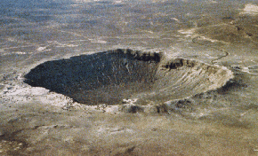 This is the Barringer Meteor Crater in Arizona. The diameter is 1.2 kilomters, and it is 49,000 years old. Courtesy of D. Roddy and LPI |  This is an image of lightning. Courtesy of JPL |
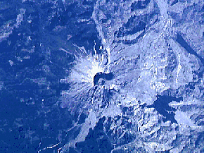 This is a satellite image taken of Mount St. Helens Volcano on October 16, 1994 from STS-64. This volcano erupted on May 18, 1980 in Washington. Courtesy of Volcano World | 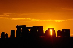 The Sun shining through the Stonehenge monument. Sun rise on the summer solstice was the most important time the Sun would shine through the monument. Windows to the Universe original image |
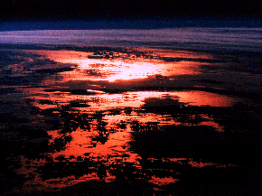 This is an image of the sun reflecting on the ocean Aris Multimedia Entertainment, Inc. 1994 | 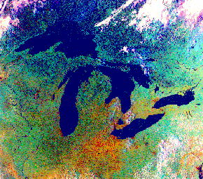 This is a satellite image of the Great Lakes in North America. Image Courtesy Environmental Research Institute of Michigan,Ann Arbor. |
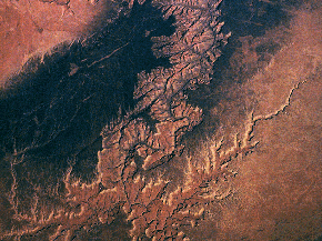 This is an image of the Grand Canyon in Arizona. It is 277 miles long and up to 18 miles across. Aris Multimedia Entertainment, Inc. 1994 | 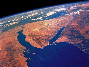 This is an image of the Sinai Desert in the Middle East. Aris Multimedia Entertainment, Inc. 1994 |
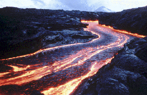 This is an image of lava channels during the eruptions of Pu'u O'o Volcano, Hawaii. The central channel shown here is approximately 4 meters (13 feet) wide. Courtesy of S. Rowland/LPI | 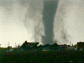 This is a typical image of a tornado spawning from a large cumulonimbus cloud. Courtesy of NOAA Storm Spotters Guide and the University of Illinois Cloud Catalog |


