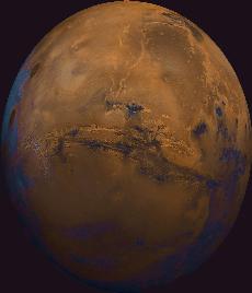
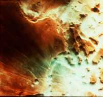
Valles Marineris, from U.S. Geological Survey Mars Digital Image Mosaic, reproduced at a scale of 230 meters/pixel.
Click on image for full size
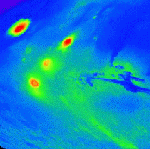
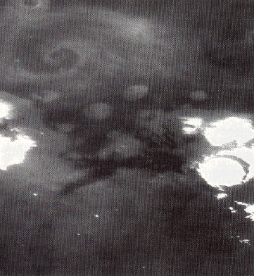
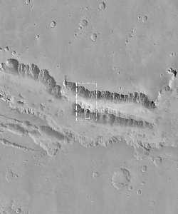
Image from: Malin Space Science Systems

More about Valles Marineris

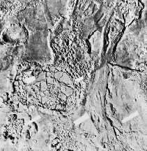
This image shows the steep slopes of Valles Marineris at higher resolution. Very high resolution images returned by the Mars Global Surveyor spacecraft allow closer examination of this unusual canyon. These images show slopes descending steeply to the north and south

You might also be interested in:

Valles Marineris

Next to the Tharsis Ridge is Valles Marineris. Valles Marineris is a large system of canyons that stretches 4000 km (2500 mi) along the equator of Mars. It was first imaged in detail by Mariner 9. As can...more

Martian Volcanoes

On this map of Mars, the lightly cratered Tharsis Ridge is shown, as well as the heavily cratered Martian highlands (near the bottom of the picture), and Valles Marineris to the right. The volcanoes are...more

The Transfer of Water in Martian History

On Mars, the water is trapped, frozen, within the ground. Nevertheless, there is evidence for running water on Mars. When the water is melted and released to the surface, it will run from higher ground...more

The Martian Cryosphere

The drawing shows a crossection of the crust, and the unusual altitude variation of the Martian surface. The figure illustrates the depth of frozen ground at various latitudes, called the cryosphere. The...more

Martian Floods

Separate from the Martian outflow channels, or the river valley networks, are large Martian lakes (600 km, or ~1000 miles across) which exhibit evidence of a periodic and catastrophic release of water...more

Martian Fog

This is an image of fog in a Martian canyon. The presence of fog provides evidence of water, and a water cycle on Mars. More fog has been seen in images returned by Mars Global Surveyor of the south polar...more

Martian Orbital Eccentricity

The Martian climate is more influenced by the shape of the Martian orbit than the climate of the Earth is influenced by the shape of the Earth's orbit. The orbit of Mars is more oval-shaped than that...more

Martian Storm

This is an image of a storm moving across the Martian terrain. The camera is looking down upon the storm and the storm front forms a spiral pattern, the same way terrestrial storms are presented on the...more

Windows to the Universe, a project of the National Earth Science Teachers Association, is sponsored in part is sponsored in part through grants from federal agencies (NASA and NOAA), and partnerships with affiliated organizations, including the American Geophysical Union, the Howard Hughes Medical Institute, the Earth System Information Partnership, the American Meteorological Society, the National Center for Science Education, and TERC. The American Geophysical Union and the American Geosciences Institute are Windows to the Universe Founding Partners. NESTA welcomes new Institutional Affiliates in support of our ongoing programs, as well as collaborations on new projects. Contact NESTA for more information. NASA ESIP NCSE HHMI AGU AGI AMS NOAA