Climate & Global Change Image & Multimedia Gallery
Atmosphere | Clouds | Weather
Atmosphere
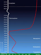
This is an image showing the temperature of the atmosphere throughout different
layers. (Windows Original)
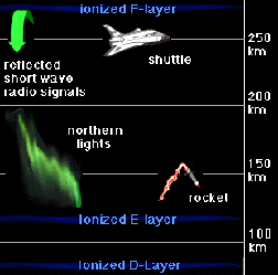
This is an image showing the layers of the atmosphere with emphasis on the
ionized layers. (Windows Original)

These are images comparing amounts of ozone and ClO between two years. (Courtesy
of NASA)

These are images comparing amounts of ozone and ClO between two other years.
(Courtesy of NASA)
Clouds
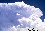
This is an image taken of cumulonimbus clouds in the atmosphere. (Courtesy of
Aris Multimedia Entertainment, Inc. 1994)
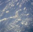
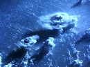
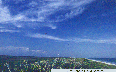
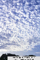
This is a satellite image taken of clouds.
This is another satellite image taken of clouds.
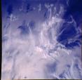
This is another satellite image taken of clouds.
This is an image of a supercell. This occurs when cumulonimbus clouds quickly
develop into powerful thunderstorm clouds. (courtesty of Kevin Knupp, University
of Illinois cloud catalog)
This is a picture of cirrus fall streaks which usually occur in good weather.
They form when snowflakes and ice crystals fall from the high clouds. (courtesy
of University of Illinois cloud catalog)
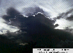
This is an image of a cumulonimbus cloud while the sun is setting behind it.
(Courtesy of Ronald Holle, University of Illinois cloud catalog)
These are altocumulus clouds which appear to be puffy. (courtesy of Ronald
Holle, University of Illinois cloud catalog)
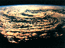
This infrared image of the Earth was taken by the GOES 6 satellite on September
21, 1986. A temperature threshold was used to isolate the clouds. The land
and sea were separated and then the clouds, land and sea were separately colored
and combined back together to produce this image. (Courtesy Rick Kohrs)
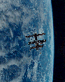
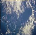
Image of clouds taken by the STS-63.
Weather
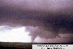
This is a typical image of a tornado spawning from a large cumulonimbus cloud.
(Courtesy of NOAA Storm Spotters Guide and the University of Illinois Cloud
Catalog)
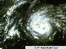
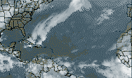
This is a satellite picture of a hurricane over Mississippi and Louisiana.
The eye is in the center where there are low winds and no precipitation.
(Courtesy of University of Illinois Cloud Catalog)
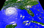
This is a satellite picture of Hurricane Andrew in 1992. (Courtesy of NASA)
This is an image of a Cyclonic Storm. (courtesy of Aris Multimedia Entertainment,
Inc. 1994)
This is an image of a tropical storm. (courtesy of Aris Multimedia Entertainment,
Inc. 1994)

Lightning. (image courtesy of JPL)

Lightning. (image courtesy of JPL)

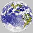
This image of the Earth was taken by the Galileo spacecraft at about 6:10 a.m.
PST on December 11, 1990. The spacecraft was about 1.3 million miles from the
Earth. South America is near the center of the picture, and the white, sunlit
continent of Antarctica is below. Picturesque weather fronts are visible in
the South Atlantic, lower right. (courtesy of NASA/JPL)
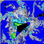
This is an image of an Antarctic Surface Plot of weather.
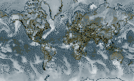
This is an example of what a current weather map looks like.
This is another example of what a current weather map looks like.
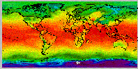
This is an image of what a current minimum temperature map would look like.