Click on image for full size
Courtesy of NOAA
Related links:
Tide Glossary Supported by Manly Hydraulics Laboratory
NOAA's Tide Tables - Tides Online
Tidewater Map of the lower Chesapeake Area Where the HIGH TIDE project is making measurements of the water in the area...
NOAA's homepage National Oceanic and Atmospheric Administration
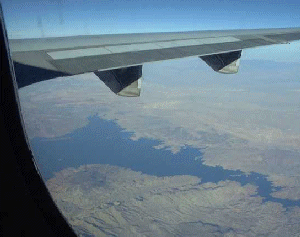
Tidewater
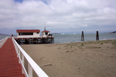
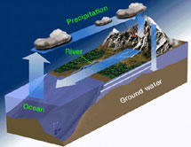
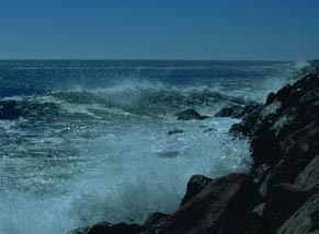
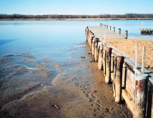
Have you ever walked along a beach at low tide? Everyone likes to look for uncovered sea shells or the small creatures in leftover puddles of water during low tide. One thing is for sure, low tide can look really different than high tide!Tidewater is water that is affected by the ebb and flow of tides. A tidewater region is a region that is affected by tides. When you hear someone say they live on the coast of an ocean or sea, they live in a tidewater region. Rivers that flow into the ocean, estuaries, and salt marshes are also affected by the tides and so are important parts of a tidewater region.
The ebb and flow of tides has a large effect on life in a tidewater region. People need to know how far out to put their boat so that the boat doesn't get stuck (and possibly damaged!) in the bottom of the empty sea during low tide. It also affects the time when you may want to go to the beach and where and when you (or a fishing company) would catch the most fish. Tides affect the amount of nutrients in the water, and other water characteristics like salinity and temperature which greatly affect ocean creatures that live in coastal waters, estuaries, rivers near the sea, or salty marshes. Tides are so important that some creatures base their feeding or reproductive schedules mainly on the tidal cycle.
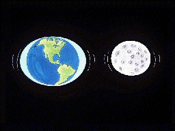
Gravitational forces of the Moon and Sun on the Earth cause tides. As the tide flows in, water level rises and rises. When the water reaches its highest level, it is considered high tide. After the point of high tide, the waters ebb away. When the water reaches its lowest point, it is considered low tide. The high tide-low tide cycle can occur once a day in some places, twice a day in others. The water level difference between high and low tide varies from a few centimeters to 13 meters depending on the location. Tide tables are put together for coastal areas around the world that tell us when high and low tide will occur for a given place on a given day.