Courtesy of NOAA Photo Library, NOAA Central Library, National Weather Service Forecast Office of Topeka, KS/ KHP
Type of Wind: Microburst
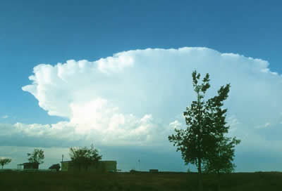
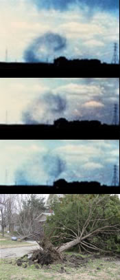
Microbursts are dangerous winds that are created by thunderstorms. A microburst is a downdraft that hits the ground and spreads horizontally with a burst of wind. The strong downdraft causing the microburst is formed by cooling. The cooling is caused by evaporation in a cloud. Once the strong downdraft has formed, it is trying to push the cool air out of the cloud to create a balance with the warm temperatures of the surrounding air.
A microburst produces straight-line winds. These winds can be greater than 104 mph (167 kph) and as much as 168 mph (270 kph); the wind speeds can be equal to the winds of small tornadoes. The difference between a microburst and a tornado is that the wind from a microburst is pushed out of the storm. Wind from a tornado flows into the storm. The time duration for a microburst is about 5-15 minutes.
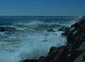
Areas affected by microbursts are 2.5 miles (4 km) or less. If the area affected is larger, then it is called a macroburst. The damage from a microburst can look similar to that of a tornado. Damage from a microburst includes blown down trees and heavy damage to poorly built structures. Ships can be damaged too if a microburst happens over water.
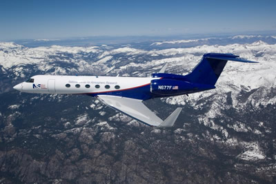
Microbursts are a major cause for airline accidents. An airplane affected by a microburst may have a loss in airspeed, loss of altitude, and major acceleration toward the ground. On August 2, 1985, a tragic plane accident occurred when a plane encountered a microburst at the Dallas-Ft. Worth Airport in Texas. This microburst had a wind speed of 80 mph (129 kph). Airports currently use Doppler radar and LLWSAS (Low Level Wind Shear Alert System) to spot microbursts and wind shears associated with microbursts. A wind shear is a sudden change in the wind speed and direction.