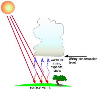
When the Sum warms the Earth, warm air rises into the atmosphere. As it rises, it expands and cools. Water vapor condenses out of the cool air to form a cloud.
Click on image for full size
Image Courtesy of CMMAP
Cloud Formation Due to Surface Heating
Some clouds form due to the heating of the Earth's surface. First, the Sun heats the ground, which then heats the air. This warm air is lighter and less dense than the surrounding air, so it begins to rise. When this air rises, it expands as it encounters the lower pressures existing at higher levels in the atmosphere. Anytime air expands due to a drop in pressure, it also gets cooler. So when the rising air expands it also cools.
The cooling air that is rising is no longer able to hold all of the water vapor it was able to hold when it was warm. This extra water vapor begins to condense out of the air parcel in the form of liquid water droplets. As the air parcel rises higher and higher, it continues to expand and get cooler, and more moisture condenses out of it.
Eventually the air rises high enough that the surrounding air in the atmosphere is the same temperature as the cooled air. This is called the equilibrium temperature. When equilibrium is reached, the air parcel stops rising and enough moisture has condensed out of it to form a cloud. The types of clouds that form from the process of surface heating are cumulonimbus (and associated mammatus clouds), cumulus, and stratocumulus.
In contrast to surface heating, the cooling of the Earth's surface leads to the development of fog and stratus clouds.
You might also be interested in:
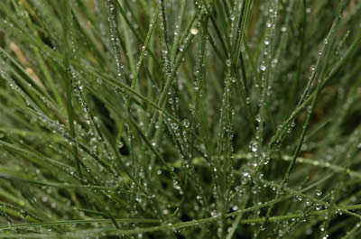
Condensation is the process by which water changes its state from a vapor or gas to a liquid. Condensation is responsible for the formation of clouds. Common examples of condensation are: dew forming on
...more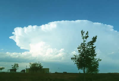
Cumulonimbus (weather symbol - Cb) clouds belong to the Clouds with Vertical Growth group. They are generally known as thunderstorm clouds. A cumulonimbus cloud can grow to such heights that it actually
...more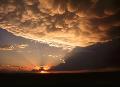
Mammatus clouds are pouches of clouds that hang underneath the base of a cloud. They are most often associated with cumulonimbus clouds, and they indicate that a storm is particularly strong. These clouds
...more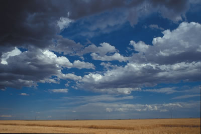
Cumulus (weather symbol - Cu) clouds belong to the Clouds with Vertical Growth group. They are puffy white or light gray clouds that look like floating cotton balls. Cumulus clouds have sharp outlines
...more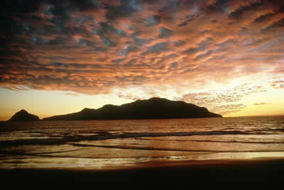
Stratocumulus (weather symbol - Sc) clouds consist of water droplets and belong to the Low Cloud (surface-2000m) group. These clouds are low, lumpy, and gray. These clouds can look like cells under a microscope
...more
Stratus (weather symbol - St) clouds consist of water droplets and belong to the Low Cloud (surface-2000m up) group. They are uniform gray in color and can cover most or all of the sky. Stratus clouds
...more
A cloud is composed of tiny water droplets or ice crystals that are suspended in the air. A series of processes have to happen in order for these water droplets or ice crystals to form into clouds in the
...more