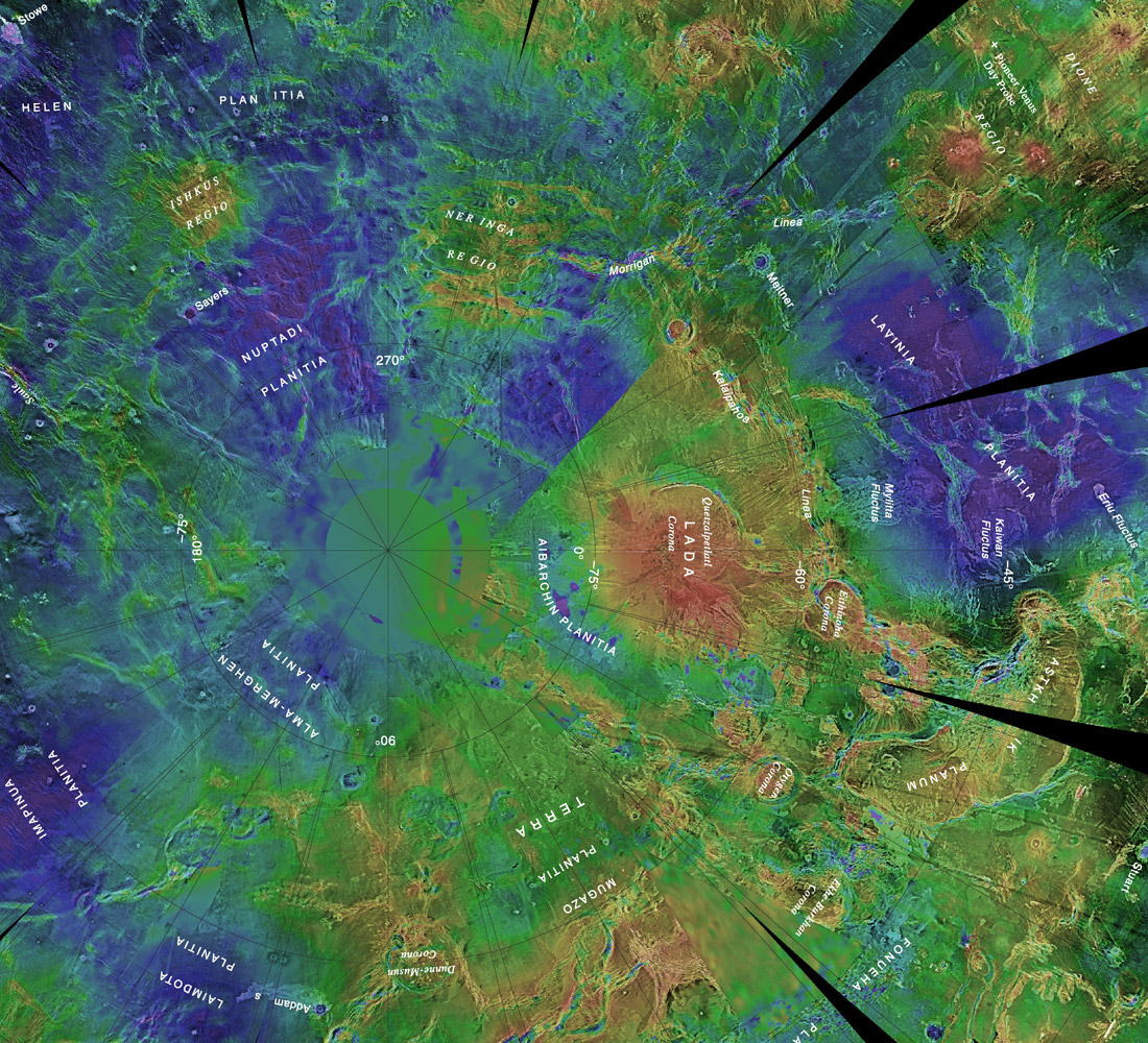
This radar map of the area around the South Pole of Venus is color-coded to show surface elevations. The South Pole is just to the left of the center of the image. This map was created using radar data from the Magellan spacecraft. Some areas near the pole were not imaged by Magellan, and are displayed blurred on the map.
Image courtesy of NASA/JPL/USGS.