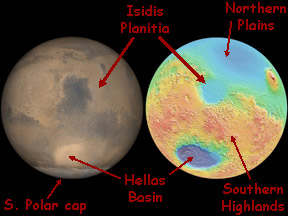
This image shows the location of Isidis Planitia and several other features on a globe of Mars. The globe on the left is roughly how the Eastern Hemisphere of Mars would look to your naked eye. The right-hand globe is an "elevation map" of Mars. Red and orange indicate highlands and green and blue indicate lower elevations. The two globes don't quite match; you would need to turn the elevation map globe slightly to the right to have the same viewpoint as shown in the other globe.
Click on image for full size
NASA/JPL/Malin Space Science Systems and the Mars Orbiter Laser Altimeter (MOLA) Team at NASA's Goddard Space Flight Center
Isidis Planitia
Isidis Planitia is flat plain within an ancient impact
crater on the
surface of Mars. Isidis Planitia is about
1500 km (930 miles) across. It is just north of the Martian equator near
the center of the Eastern
Hemisphere of the Red Planet. Its center is located at approximately 13° North
latitude and 87° East longitude.
The impact crater was probably formed around three to four billion years
ago when a comet or a 50 km (31 mile)
diameter asteroid slammed
into Mars. Scientists think the floor of the crater may have been flooded
by lava at some later time. Later
still sedimentary
deposits may have buried the lava flows. Isidis Planitia lies along
the boundary between the ancient
Martian highlands that cover the southern portion of the planet and
the younger plains
that dominate Mars' Northern Hemisphere. Some scientists
believe that Mars once had abundant liquid water on its surface, and
that the northern plains might have once been under oceans. If that is
true, Isidis Planitia might have been a bay of the northern seas jutting
into the southern highlands, or a large lake near
the edge of the northern seas.
An area
within the eastern part of Isidis Planitia is the intended target
of the Beagle
2 lander portion of the European Space Agency's (ESA's)
Mars Express
mission. Beagle 2's mission is to search for signs of life.
ESA mission planners thought Isidis Planitia would be a good place to
land and search for life because
of the likelihood that there was once water in the area.
You might also be interested in:

How did life evolve on Earth? The answer to this question can help us understand our past and prepare for our future. Although evolution provides credible and reliable answers, polls show that many people turn away from science, seeking other explanations with which they are more comfortable.
...more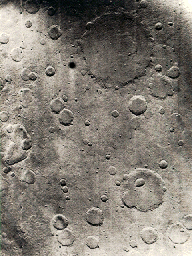
This is an example of the cratered terrain on Mars. Almost the entire surface of Mars is cratered to various degrees. The Tharsis Ridge, where the volcanoes of Mars are located, is lightly cratered. The
...more
Not long ago, many people thought that comets were a portent that something bad was about to happen to them. Since people did not yet understand about the objects in the solar system and how they moved,
...more
Asteroids are small bodies that are believed to be left over from the beginning of the solar system 4.6 billion years ago. They are rocky objects with round or irregular shapes up to several hundred km
...more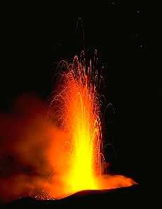
Lava is the word for magma (molten rock) which is extruded onto the surface of the Earth. Upon being released from the magma chamber and cooling, lava solidifies into rock. The term lava is used to describe
...more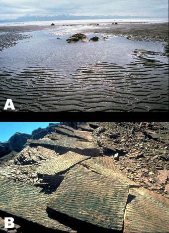
Sedimentary rocks make up about 75% of the rocks that are at the Earths surface. They preserve a chronicle of the environments and events that happened at the surface throughout Earth history, as well
...more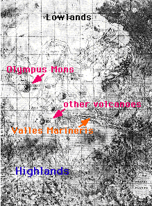
The surface of Mars can be broken into two main regions: highlands and lowlands. The highlands are in the southern hemisphere (the bottom of the figure), and the lowlands are in the northern hemisphere
...more
When we ask "Where might we find extraterrestrial life", the first place many scientists turn to, because of its similarity to the Earth, is Mars. Mars is the closest analog to the Earth in both the present
...more