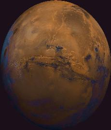
Valles Marineris, the grand valley of Mars named after the Mariner program which first took close-up images.
Click on image for full size
Image from: USGS
Valles Marineris
Next to the Tharsis Ridge is Valles Marineris, a very long canyon of Mars.
As can be seen in the image, many huge ancient rivers extend toward the top of the image. The three Tharsis
volcanoes (dark red spots) are visible on the leftmost edge of the image. To the south are the highlands; very ancient ground, covered by many craters.
Better images returned by the Mars Global Surveyor spacecraft allow a closer look of this unusual canyon. These images show slopes descending steeply to the north and south
in broad,
debris-filled gullies. These gullies look a lot like canyons on Earth.
You might also be interested in:

What types of instructional experiences help K-8 students learn science with understanding? What do science educators teachers, teacher leaders, science specialists, professional development staff, curriculum designers, school administrators need to know to create and support such experiences?
...more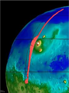
This image, taken from the Mars Global Surveyor mission (MGS), shows the Tharsis Ridge, the green/blue area in the middle of the picture, as well as a portion of the southern hemisphere of Mars. The green
...more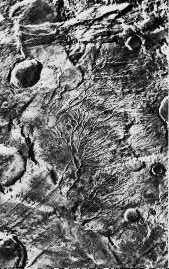
Mars doesn't seem to have very much water. If Mars had lots of water life could survive there. There seems to be *some* water because clouds, fog, and icy polar caps are seen on Mars today. There are also
...more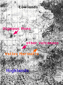
The surface of Mars can be broken into two parts, the highlands and lowlands. The highlands are in the southern hemisphere (the bottom of the picture). The lowlands are in the northern hemisphere of Mars
...more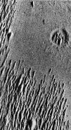
Over the course of time there are many things which can cause the surface of a planet to change its appearance. winds slowly wear away the surface. weather & water, which cause a planet's surface to be
...more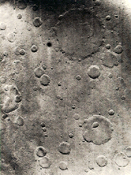
This is an example of the cratered surface of Mars. Almost all of the surface of Mars is covered with craters. Craters can be wiped out over time, so a surface which has many craters is very old. The lowlands
...more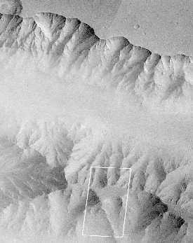
The mission of Mars Global Surveyor (MGS for short) is to map the surface of Mars from space. MGS is also looking at the atmosphere of Mars and the weather of Mars. MGS and the Mars Pathfinder (MPF for
...more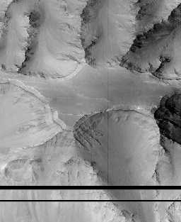
This view of Valles Marineris shows debris-filled gullies very much like canyons on Earth. The layered rocks seen in these images indicates that there may have been a complicated and active early history
...more