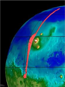
A representation of the Tharsis Ridge, showing the altitude of the volcanoes compared to the surrounding areas. The elevated southern hemisphere is also shown. From Mars Global Surveyor.
Click on image for full size
NASA/JPL
The Tharsis Ridge
This image, taken from the Mars Global Surveyor mission (MGS), shows the Tharsis Ridge, the green/blue area in the middle of the picture, as well as a portion of the southern hemisphere of Mars. The green areas are higher than the surroundings, and the yellow/white regions, which are actually Martian volcanoes, are the highest of all. The red line in the picture is the spacecraft measurement which indicates just how large the regions are compared to one another.
The Tharsis Ridge is a region about twice the size of the United States (8000 km), and is where many of the volcanoes of Mars are found. Measurements by all spacecraft visiting Mars, including recent ones by Mars Pathfinder and Mars Global Surveyor have indicated that this region of Mars is actually a giant bulge, as shown in the picture. The picture also shows how much higher the southern hemisphere of Mars is than the rest of the planet.
The volcanoes found on this Ridge are very large volcanoes indeed. The Ridge is the home of Olympus Mons and other volcanoes.
You might also be interested in:
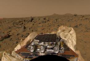
People were really excited when Pathfinder landed on Mars on July 4, 1997. The Mars Pathfinder mission (MPF for short!) was sent to Mars to look at the rocks and soil of Mars. The MPF was actually 2 parts,
...more
This drawing shows another way that islands are made. A rising hot bubble of material finds it's way into the crust of the Earth from the deep interior, and begins to erupt. This bubble or "plume" is called
...more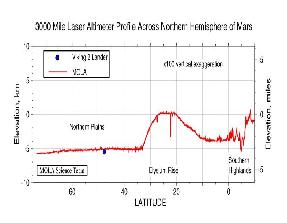
Mars Global Surveyor carries an instrument which measures the heights of things. The picture to the left shows Mars Global Surveyor's measurement of the size of the giant cliff which separates the southern
...more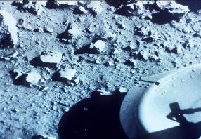
The Viking I and Viking 2 missions were to both orbit Mars and land on the planet's surface. There were two spacecraft for each mission. At this stage in the history of the exploration of Mars, scientists
...more
During its earliest history, Mars was hit with many asteroid-like boulders. The impacts of these boulders caused Mars to become warm enough for continents to drift across the surface just as they do on
...more
Mars is not quite right for life as we know it on Earth. On a cold planet like Mars, water can become frozen into the ground. This water can only be turned into running water when the weather is warm enough.
...more


