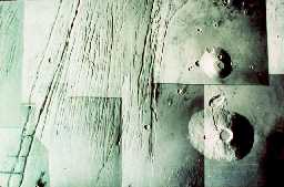
This is an image of some Martian volcanoes.
Click on image for full size
Image from: NASA
The History of Martian Volcanism
During its earliest history, Mars was bombarded with *planetismals*. The impacts of these asteroid-like boulders caused the surface regions of Mars to become warm enough for continents to drift across the surface just as they do on Earth to this day. When the lithosphere became immovable, what may once have been a supercontinent froze in place, in the southern hemisphere, becoming what is now the highlands of Mars.
Evidence for this theory can be found with an examination of the global geography of Mars, together with the cratering pattern.
The cratering evidence suggests that Mars may have warmed from the inside late in its forming history, causing volcanism *after* the lithosphere became immovable. This period of volcanism is what created the Tharsis Bulge, Olympus Mons, and the other volcanoes. The volcanoes poured out a new surface over the lowlands of Mars, which received a lighter load of bombardment than did the older highlands. The lowlands, where the volcanoes are found, are cratered at a rate which suggests an age of 3.7-3.8 Billion Years. The highlands are much older.
The cratering record suggests that after this period however, all volcanic activity on Mars ceased. There seem to be no features younger than 3.5 Billion Years.
You might also be interested in:
On this map of Mars, the lightly cratered Tharsis Ridge is shown, as well as the heavily cratered Martian highlands (near the bottom of the picture), and Valles Marineris to the right. The volcanoes are
...more
The unusual global geography of Mars helps to explain the fact that water has been drawn from the southern hemisphere to the northern hemisphere of the planet through all of Martian history (that is, from
...moreThe Martian geography is one of high altitudes at high southern latitudes and low altitudes at low latitudes. The ground is less frozen at low latitudes because it is warmer and water can evaporate. Thus,
...more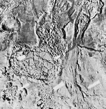
Separate from the Martian outflow channels, or the river valley networks, are large Martian lakes (600 km, or ~1000 miles across) which exhibit evidence of a periodic and catastrophic release of water
...more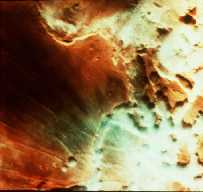
This is an image of fog in a Martian canyon. The presence of fog provides evidence of water, and a water cycle on Mars. More fog has been seen in images returned by Mars Global Surveyor of the south polar
...more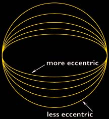
The Martian climate is more influenced by the shape of the Martian orbit than the climate of the Earth is influenced by the shape of the Earth's orbit. The orbit of Mars is more elliptical than that of
...more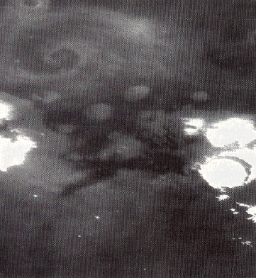
This is an image of a storm moving across the Martian terrain. The camera is looking down upon the storm and the storm front forms a spiral pattern, the same way terrestrial storms are presented on the
...more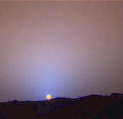
This is image of a Martian sunset illustrates just how thin the Martian atmosphere is. The terrestrial "blue sky" comes about because molecules of the atmosphere scatter sunlight. In this image, the Martian
...more