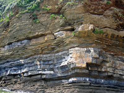
Ancient sediments like these in Brittany, France, help reconstruct Paleozoic sea-level history.
Click on image for full size
Image Courtesy of Bil Haq, NSF
Paleozoic "Sediment Curve" Provides New Tool for Tracking Sea-floor Sediment Movements
News story originally written on October 2, 2008
Geologists have been studying a new way to learn where sedimentary rocks formed during the Paleozoic Era.
Balil Haq, a marine biologist, explains that scientists are using something called a sediment curve shows where sediment-on-the-move is deposited during the development of sedimentary rocks. This information helps scientists understand what happens when sea level rises and falls. Scientists can also use this information to interpret Earth history and learn where sediments are deposited to form rocks.
"We hope that the publication of a sediment curve for this entire era will enhance interest in Paleozoic geology," said Haq, "and help the exploration industry in its efforts to look at older and deeper sediments."
In addition to adding to scientific understanding, what scientists learn on this topic will help the oil industry to discover oil in places where searches have never taken place.
You might also be interested in:
If you sneeze into a pile of dust the little particles fly everywhere, but if you sneeze into a pile of rocks, they will stay put. It takes more force than a sneeze to move those rocks. Winds and water
...more
Sea level is the height of the ocean surface. Scientists measure sea level to figure out how much sea level rise is happening now because of global warming. If you tried to draw a flat line at the top
...more
When water or wind slows down, sediment can no longer be carried in it. The particles of sediment fall through the water or air and form a blanket of sediment on the bottom of a river, a lake, ocean,
...more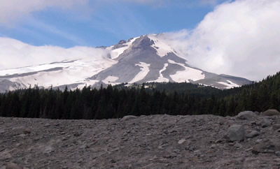
Scientists have learned that Mount Hood, Oregon's tallest mountain, has erupted in the past due to the mixing of two different types of magma. Adam Kent, a geologist at Oregon State University, says this
...more
The Earth's mantle is a rocky, solid shell that is between the Earth's crust and the outer core. The mantle is made up of many different reservoirs that have different chemical compositions. Scientists
...more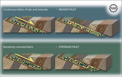
Some faults look strong and like they wouldnt cause an earthquake. But it turns out that they can slip and slide like weak faults causing earthquakes. Scientists have been looking at one of these faults
...more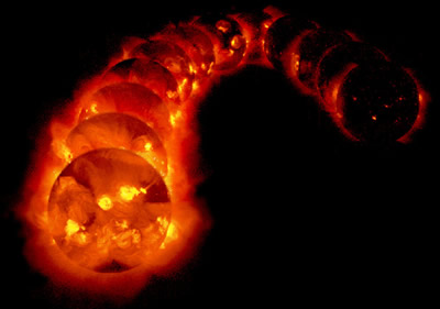
The sun goes through cycles that last approximately 11 years. These solar cycle include phases with more magnetic activity, sunspots, and solar flares. They also include phases with less activity. The
...more