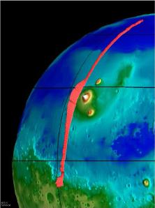
The Mars Global Surveyor spacecraft measures The Tharsis Ridge.
Click on image for full size
NASA/JPL
Altimetry
Altimetry is a term which describes a method of measuring the altitudes of things with spacecraft. It is usually performed with a laser. Lasers bounce beams of light from the surface and back to the spacecraft to measure the heights of mountains and depths of valleys on distant planets. This is even done for our own planet. The figure shown here shows altimeter results from the Mars Global Surveyor spacecraft. The red line shows the relative heights of the ground underneath the spacecraft.
You might also be interested in:
Mars Global Surveyor carries an instrument which measures the heights of things. This instrument is called an altimeter, or "altitude-meter". The graph to the left shows the results returned from Mars
...more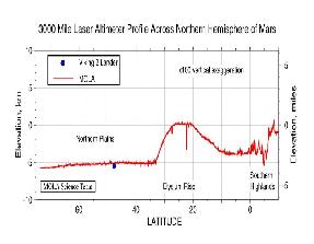
Mars Global Surveyor carries an instrument which measures the heights of things. The picture to the left shows Mars Global Surveyor's measurement of the size of the giant cliff which separates the southern
...more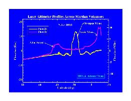
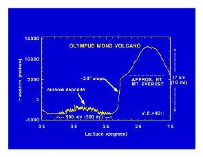
Mars Global Surveyor carries an instrument which measures the heights of things. The picture to the left shows the results returned from Mars Global Surveyor's measurement of the size of some of the Martian
...more
It has been more than 30 years since America's first missions to Mars. Here are some of the instruments carried by the Mars Global Surveyor (called MGS for short). These instruments are designed to study
...more
AU stands for Astronomical Units. It is an easy way to measure large distances in space. It is the distance between the Earth and the Sun, which is about 93 million miles. For really big distances, we
...more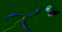
The solar wind is formed as the Sun's top layer blows off into space. It carries magnetic fields still attached to the Sun. Streams appear to flow into space as if they are spiraling out from the Sun,
...more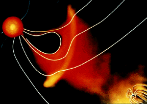
For a planet to be affected by a blob of material being ejected by the sun, the planet must be in the path of the blob, as shown in this picture. The Earth and its magnetosphere are shown in the bottom
...more