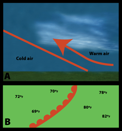
A side view of a warm front (A) and how it is represented on a weather map (B)
Click on image for full size
Windows to the Universe image by Lisa Gardiner
Warm Fronts
A warm front is where a warm air mass is pushing into a colder air mass. Warm fronts move more slowly than cold fronts because it is more difficult for the warm air to move against the cold, dense air.
You will often see high clouds like cirrus, cirrostratus, and middle clouds like altostratus ahead of a warm front. These clouds form in the warm air that is high above the cool air. As the front passes over an area, the clouds become lower and rain is likely. There can be thunderstorms around the warm front if the air is unstable.
On weather maps, the surface location of a warm front is represented by a solid red line with red, filled-in semicircles along it, like in the map on the left (B). The semicircles indicate the direction that the front is moving. They are on the side of the line where the front is moving. Notice on the map that temperatures at ground level are cooler in front of the front than behind it.
Last modified August 12, 2009 by Lisa Gardiner.
You might also be interested in:
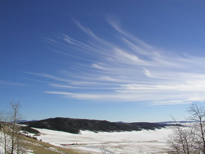
Cirrus clouds are the most common of the High Cloud (5000-13000m) group. They are composed entirely of ice and consist of long, thin, wispy streamers. They are commonly known as "mare's tails" because
...more
Cirrostratus clouds belong to the High Cloud (5000-13000m) group. They are sheetlike thin clouds that usually cover the entire sky. The sun or moon can shine through cirrostratus clouds . Sometimes, the
...more
Altostratus belong to the Middle Cloud group (2000-7000m up). An altostratus cloud usually covers the whole sky and has a gray or blue-gray appearance. The sun or moon may shine through an altostratus
...more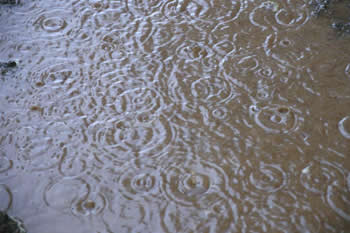
Rain is precipitation that falls to the Earth in drops of 5mm or more in diameter according to the US National Weather Service. Virga is rain that evaporates before reaching the ground. Raindrops form
...more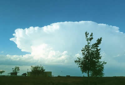
Thunderstorms are one of the most thrilling and dangerous types of weather phenomena. Over 40,000 thunderstorms occur throughout the world each day. Thunderstorms form when very warm, moist air rises into
...more
When a front passes over an area, it means a change in the weather. Many fronts cause weather events such as rain, thunderstorms, gusty winds, and tornadoes. At a cold front passes there may there may
...more
Weather fronts can cause clouds to form. Fronts occur when two large masses of air collide at the Earth's surface. Warm fronts produce clouds when warm air replaces cold air by sliding above it. Many different
...more