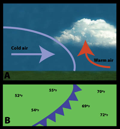
A side view of a cold front (A) and how it is represented on a weather map (B)
Click on image for full size
Windows to the Universe image by Lisa Gardiner
Cold Fronts
A cold front is where a cold air mass is pushing into a warmer air mass. Cold fronts can produce dramatic changes in the weather. They move fast, up to twice as fast as a warm front. Cold air is dense so it is able to quickly plow a warm air mass ahead of it.
Commonly, when the cold front is passing, winds become gusty; there is a sudden drop in temperature, and heavy rain, sometimes with hail, thunder, and lightning. Lifted warm air ahead of the front produces cumulus or cumulonimbus clouds and thunderstorms. Atmospheric pressure changes from falling to rising at the front. After a cold front moves through your area you may notice that the temperature is cooler, the rain has stopped, and the cumulus clouds are replaced by stratus and stratocumulus clouds or clear skies.
On weather maps, a cold front is represented by a solid blue line with filled-in triangles along it, like in the map on the left (B). The triangles are like arrowheads pointing in the direction that the front is moving. Notice on the map that temperatures at ground level are warmer in front of the front than behind it.
Last modified August 12, 2009 by Lisa Gardiner.
You might also be interested in:

Wind is moving air. Warm air rises, and cool air comes in to take its place. This movement creates different pressures in the atmosphere which creates the winds around the globe. Since the Earth spins,
...more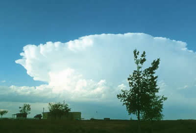
Thunderstorms are one of the most thrilling and dangerous types of weather phenomena. Over 40,000 thunderstorms occur throughout the world each day. Thunderstorms form when very warm, moist air rises into
...more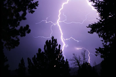
Lightning is the most spectacular element of a thunderstorm. In fact it is how thunderstorms got their name. Wait a minute, what does thunder have to do with lightning? Well, lightning causes thunder.
...more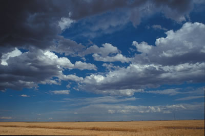
Cumulus clouds belong to the Clouds with Vertical Growth group. They are puffy white or light gray clouds that look like floating cotton balls. Cumulus clouds have sharp outlines and a flat base. Cumulus
...more Cumulonimbus clouds belong to the Clouds with Vertical Growth group. They are generally known as thunderstorm clouds. A cumulonimbus cloud can grow up to 10km high. At this height, high winds will flatten
...more
Stratus clouds belong to the Low Cloud (surface-2000m up) group. They are uniform gray in color and can cover most or all of the sky. Stratus clouds can look like a fog that doesn't reach the ground.
...more
Stratocumulus clouds belong to the Low Cloud (surface-2000m) group. These clouds are low, lumpy, and gray. These clouds can look like cells under a microscope - sometimes they line up in rows and other
...more