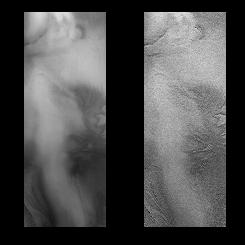
Part of the layered terrain at 75 degrees S. latitude.
Click on image for full size
Image from: Malin Space Science Systems
The Mars '98 Landing Site
This image of a potential landing site for the
Mars '98 mission was provided by the
Mars Global Surveyor mission. The landing site was suppose to be in the
south polar region of Mars.
In the image, ground fog obscures part of the landscape. Nevertheless, it can be seen that there are swirling bands of eroded, layered rock present. These rocky layers seem to have a familiar form, somewhat like the edges of Alaskan ice sheets. The landscape seems to be more rugged and geologically diverse than scientists had expected. The Mars Global Surveyor mission took more images of possible landing sites for Mars '98, but unfortunately, communication with the Mars '98 lander was lost, so the probe never got to land on Mars!
You might also be interested in:
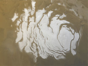
The Martian South Pole was first imaged by Mariner 7. The south polar region is part of the highlands of Mars, consisting of old, cratered terrain, and other interesting geologic features. The Mariner
...more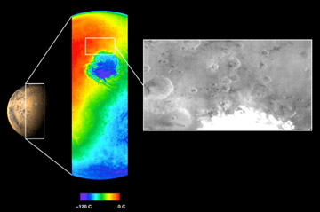
The Mars Odyssey was launched April 7, 2001, from Cape Canaveral Air Force Station in Florida. After a six-month, 285 million-mile journey, the Odyssey arrived at Mars on October 24, 2001 (02:30 Universal
...more
The Mars 2005 mission is still in the planning stages. It is set to launch in the year 2005.
...more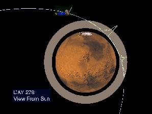
On September 12, 1997, the Mars Global Surveyor successfully entered a highly elliptical orbit around Mars. To get into the near-circular, near-polar, low-altitude orbit necessary to map the surface of
...more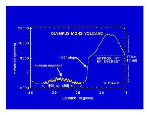
Mars Global Surveyor carries an instrument which measures the altitudes of things. The instrument is called an altimeter, or "altitude-meter". The graph to the left shows the results returned from Mars
...more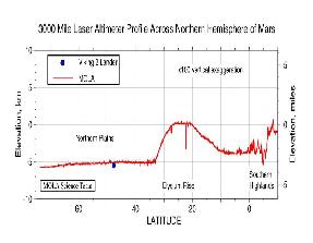
Mars Global Surveyor carries an instrument which measures the altitudes of things. The instrument is called an altimeter, or "altitude-meter". The graph to the left shows Mars Global Surveyor's measurement
...more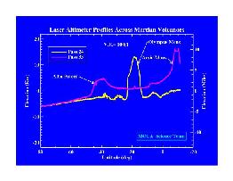
Mars Global Surveyor carries an instrument which measures the altitudes of things. The instrument is called an altimeter, or "altitude-meter". The graph to the left shows Mars Global Surveyor's measurement
...more