Click on image for full size
Image Courtesy of Dennis Ward/UCAR
Related links:
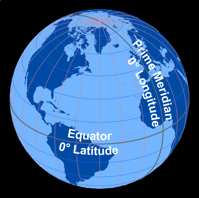
Angles Determine Latitude and Longitude
This cutaway view of the Earth shows the angular measurement of latitude and longitude.
Latitude, shown in blue, is the angular distance from the Equator to a point on the Earth's surface. Latitude can either be North or South, depending on the hemisphere in which the location is located. GPS units and digital mapping applications, such as Google Earth, often indicate northern latitudes as being positive (0 to +90 degrees), and give southern latitudes negative values (0 to -90 degrees).
Longitude, shown in red, is the angular distance from the Prime Meridian to a point on the Earth's surface. Longitude is described as being either East or West, depending on which way you measure from the Prime Meridian, and ranges from 0 degrees at the Prime Meridian, to 180 degrees at the Antimeridian. Digital maps use positive numbers for eastern longitudes (0 to +180 degrees) and negative numbers for western longitudes (0 to -180 degrees).